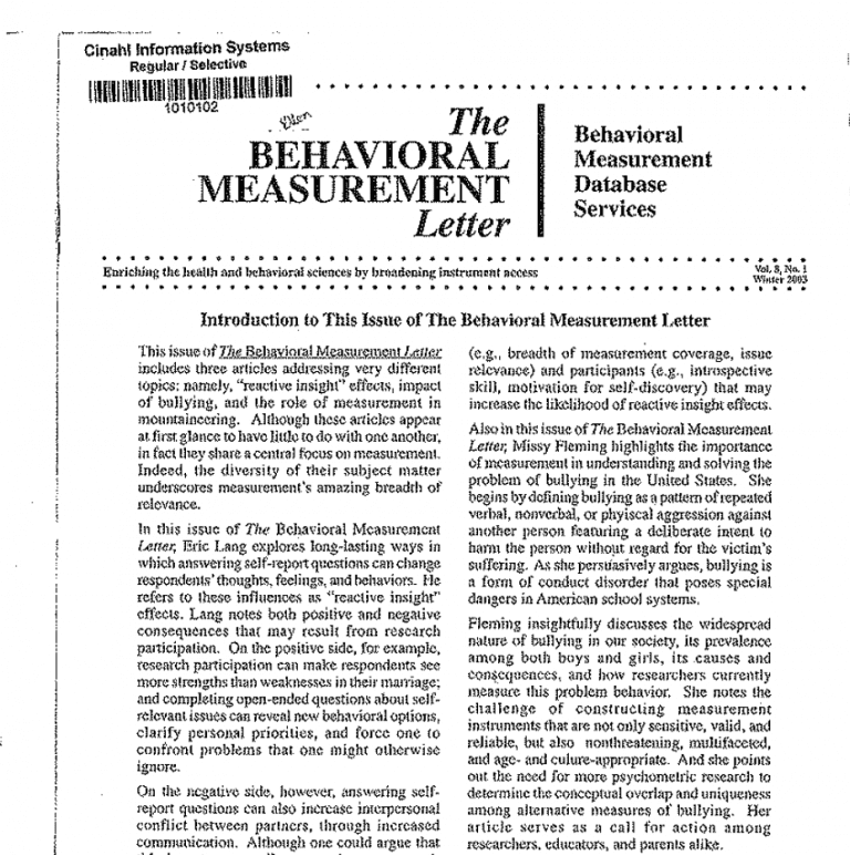
Continued article from the The Behavioral Measurement Letter, Vol. 8, No. 1: Winter 2003
Fred B. Bryant
Measurement is essential to scientific research in the natural and social sciences, driving the evolution of theory and advancement of knowledge. Measurement also is crucial in countless human endeavors other than research. Measurement is essential to practice, as well as research, in fields from a to z, from art preservation to zoo-keeping, accounting to zinc-mining, architecture to zinnia-growing In fact, it is difficult to think of any human pursuit that does not rely in some way on measurement.
The high-stakes world of high-altitude mountaineering is no exception. Both physical safety and ultimate success are dependent on computations involving measures of, for example, time and distance, and on analysis and interpretation of data generated through measurement, as in weather forecasting. The purpose of this article is to highlight the vital importance measurement plays in mountain climbing by briefly describing some of the ways in which mountaineering depends on measurement.
The need for valid, reliable measurement in mountain climbing is illustrated in the following vignettes:
- A climber breathing supplemental oxygen surveys the final stretch to the summit: Is there enough oxygen left in the bottle to reach the top and return, or should he carry another full bottle with him to the top? In 1953, Sir Edmund Hillary faced such a decision during his first ascent of Everest. Before tackling the final summit ridge, he performed the necessary computations in his head involving measures of flow-rate, time and distance, and then correctly concluded that he had enough oxygen left (Hunt, 1953). (Interestingly, the day before Hillary’s historic first ascent with Sherpa Tenzing Norgay, two other climbers, whose names-Tom Bourdillon and Charles Evans history has forgotten, became the first men to reach the final summit ridge, where they decided to torn back, given the time, distance, and oxygen supply remaining.)
- A climber approaches the summit late in the day: Is there enough sunlight left to reach the top and still get back to the highest camp. or should he turn back now? Mistakes in timing have forced climbers to bivouac overnight in the Death Zone (above 8000 meters), risking hypothermia, frostbite, or worse, as in 1978 when American Jim Wickwire barely survived an unprotected bivouac near the summit of K2 (8611 meters), the world’s second highest mountain (Ridgeway, 1980).
- A raging blizzard hits a high camp: Is there enough food and fuel left, or should the climbers descend and resupply? Miscalculations have cost climbers’ lives, for example, the deaths of seven experienced climbers in 1986 after reaching the summit of K2 when they had mistakenly failed to resupply (Curran, 1987).
As shown in the vignettes above, when making the kinds of life-and-death decisions prevalent in high-altitude mountaineering, errors in measurement or in the use of measurements can be disastrous. Clearly, then, accurate measurement, proper analysis, and the exercise of good judgment together can spell the difference between a thrilling, rewarding adventure and the ultimate nightmare.
From initial planning to the final climb, valid and reliable measurement is essential in climbing the world’s tallest mountains, known collectively as “the 8000ers.” 14 Himalayan peaks that rise above 8000 meters (Everest at $848 meters is the highest). In scaling the 8000ers, climbers rely on accurate measurement to help them safely negotiate the dangers of high altitudes. The traditional approach to climbing 8000ers is a large-scale expedition involving dozens of climbers, hundreds of porters, and many tons of supplies. To be successful, expeditions require careful planning, safe and efficient stockpiling of camps at consecutively higher altitudes, and good luck with the weather. Expedition planning thus requires accurate measurement of relevant variables, for death is the ultimate consequence of underestimating the amounts of food, fuel and equipment needed, improperly placing and stockpiling camps, or poor weather forecasting.
Of course, measurement data must be analyzed to yield meaningful information. Then that information must be interpreted. Furthermore, both data and information must be transmitted in a timely fashion to and from the base camp and between the base camp and remote technical support teams. Thus, state-of-the-art electronic technologies are increasingly being used to analyze and communicate data. For example, some expedition planners, like the British on Everest’s Southwest Face in 1975 (Bonington, 1976) use statistical software to compare projected outcomes of alternative solutions to specific logistical problems in deciding when to move what supplies where. Once on the mountain, expeditions like the 1990 Joint American-Chinese-Russian Peace climb on Everest (Whittaker, 1994) rely on computer-telecommunication links to transfer and analyze updated weather forecast data in making decisions about the movement of personnel.
A bolder, modern-day alterative to the traditional expedition approach to mountaineering is alpine-style climbing. This approach involves only 1-3 climbers who pit themselves against the mountain, lugging all essential supplies with them as they climb, relying on speed to minimize exposure to risks (Messner, 1990). In this approach, climbers trade off (a) the security of support personnel, stockpiled camps, and a “fixed” ascent route for (b) lightness and quickness on the mountain, and greater challenge. Analyses of Himalayan climbing data through 1985 indicate that climbers in expeditions run a 1 in 30 chance of being killed trying to climb an 8000er (Messner, 1988). In alpine-style climbing, on the other hand, the death rate may be closer to 1 in 3 (Child, 1993). This tenfold increase in risk makes trustworthy measurement and data analysis all the more crucial in alpine-style climbing.
In addition, given the need for speed in alpine-style climbing, rapid and accurate transmission of data are absolutely essential. Accordingly, some alpine-style climbers wear telecommunication equipment while climbing so as to receive a constant stream of vital, real-time information from their base camp concerning location, progress, physical conditions, and weather changes, just as an astronaut on the moon uses data relayed from Mission Control back on earth. In 1988, for example, Frenchman Marc Batard relied on information transmitted from observers at base camp to guide him during his 22 1/2-hour solo speed-climb of Everest without supplemental oxygen (Tabin, 1993).
In the final analysis, however, regardless of which climbing approach is employed – expedition-style or alpine-style, success or failure on the 8000ers ultimately depends on the soundness of the climber’s judgment in the face of imminent. risks. Wise decision-making is vital when flirting with the dangerous mixture of bad weather, oxygen deprivation and dehydration found at high altitudes. Faced with an approaching storm, for example, is it better to turn back or to continue climbing toward the top? Climbers must gauge how fast the storm is approaching, how long it will take them to reach the summit, and where they are in relation to the nearest camp. Each of these judgments involves measurement, data analysis ad interpretation, requiring both logic and judgment. Yet at high altitudes, perceptual and cognitive abilities, logical thinking and rational decision-making may be impaired.
Because a mistake in judgment may be their last, climbers stake their lives on accurate measuring instruments that produce valid, reliable data. Instruments such as a compass, altimeter, watch (with built-in calculator), and topographic maps provide climbers with vital information about distance, direction, speed, and weather-related changes in barometric pressure. Some climbers even carry a GPS (Globe Positioning System) communication device for instant satellite verification of position. Nonetheless, mistakes are made. False readings or mistaken inferences (among other things) can be fatal, as when six climbers died in a storm on Mount Everest in 1996 as a result of underestimating the severity of approaching weather (Krakauer, 1997). Compounding the problem, oxygen deprivation clouds perceptual judgment at high altitude, making higher-order assessments and comparisons more difficult, and thus less valid and reliable (Houston, 1980).
It is indeed ironic that climbers are most dependent on their ability to make critical distinctions at the very times when they are least capable of doing so. To improve the soundness of judgments, climbers often resort to seeking group consensus in making and interpreting measurements at high altitude, though such pooling of opinions can produce misleading conclusions if all co- participants share the same bias (Peters, 1982). Thus, just as in the social and behavioral sciences, error and bias in measurement are to be avoided in high-altitude mountaineering. But, unlike social scientists, mountaineers may not get a second chance to get it right.
References
Boningtonipooippioip, C.B. (1976). Everest the hard way. New York: Random House.
Child, G. (1993). Mixed emotions. Seaule, WA: The
Mountaineers.
Curran, J. (1987), K2, trisuaph and tragedy Seattle, WA: The Mountaineers.
Messner. R. (1988). AN 14 8000ers. (translated by Audrey Salkeld). Seattle, WA: Cloudcap Press.
Houston, C. (1980). Going high. New York: American Alpine Clab.
Hunt, J. (1993). The ascent of Riverest. London: Hodder and Stoughton,
Krakauer. J. (1997). In to thin air New York: Villard.
Peters, E. (Ed.). (1982). Mountaineering: The freedom of the hills. (4th Edition). Seattle, WA: The Mountaineers.
Ridgeway, R. (1980). The last stop: The American ascent of 12. Seattle, WA: The Mountaineers.
Tabin, G. (1998). Blind corners: Adventures on seven continents. Merrillville, IN: ICS Books,
Whittaker, J. (1994). Memoirs of a mountain guide. Seattle, WA: The Mountaineers.
Fred B. Bryant is Professor of Psychology at Loyola University, Chicago. He has roughly 90 professional publications in the areas of social psychology, personality psychology, measurement, and behavioral medicine. In addition, he has coedited 6 books, including Methodological Issues in Applied Social Psychology (1993; New York: Plenum). Dr. Bryant has extensive consulting experience in a wide variety of applied settings, including work as a research consultant for numerous marketing firms, medical schools, and public school systems; a methodological expert for the U.S. Government Accounting Office; and an expert witness in several federal court cases involving social science research evidence. Ha is currently on the Editorial Board of the journal Basic and Applied Social Psychology. His current research interests include happiness, the measurement of cognition and emotion, and structural equation modeling.
Read additional articles from this newsletter:
What’s the Big Deal About Bullying?
The Repercussions of Research Participation: Exploring Reactive Insight Effects
8-1-winter-2003

